Surrey city council is taking a dim view on proposed federal riding reconfigurations that would see the city sharing electoral districts with communities across the Fraser River.
Council approved a corporate report by Jeff Arason, Surrey’s acting general manager of engineering, planning and development, on Oct. 3 concerning the Federal Electoral Boundaries Commission’s plan to increase the number of federal ridings in Surrey to eight from five.
Arason told council the proposed reconfiguration would be “significantly impactful” to Surrey, would “not effectively reflect historical patterns or represent existing communities of interest and identify,” nor would they “adequately address the rapid growth taking place in Surrey and its impacts on electoral representation.”
Currently, Surrey’s ridings include Surrey Centre, Fleetwood-Port Kells, Cloverdale-Langley City, South Surrey-White Rock and Surrey Newton. Every 10 years, federal riding boundaries are revisited with the aim, Arason noted, of ensuring each riding’s population is “close as practicable to B.C.’s electoral quota of 116,300 people per riding.
READ ALSO OUR VIEW: Surrey’s proposed electoral map puzzling
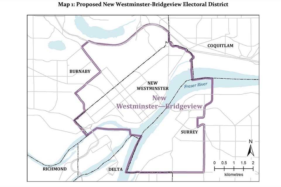
Proposed for Surrey are the ridings of Cloverdale-Langley City (population 118,518), Fleetwood-Port Kells (population 116,776), New Westminster-Bridgeview (population 118,422), Pitt Meadows-Fort Langley (population 116,538), South Surrey-White Rock (population 115,956), Surrey Centre (population 117,698), Surrey West (population 115,780) and Delta (population 117,020), which if approved would take in 72 Avenue east to King George Boulevard, south/south easterly to the BC Railway west to City of Surrey’s westerly limit.
The New Westminster-Bridgeview proposal takes in either side of the river as does Pitt Meadows-Fort Langley, which would take in Abbey Ridge in East Fraser Heights.
Coun. Laurie Guerra said when Cloverdale-Langley City was created 10 years ago she thought it “odd to combine two different cities in one riding,” even though it “shared the same landbase.”
“Now the proposed ridings are separated by a body of water and in separate cities,” she noted. “To me this didn’t make sense at all, it doesn’t make sense. The purpose of federal ridings is to have an elected member of parliament who represents the constituents in their riding, in fact it’s a cornerstone of our democracy. Picture yourself living in New West or Coquitlam and having to share your member of parliament with Surrey.”
Guerra also questioned adding the area east of Highway 1 to Surrey Centre as it shares no common schools, community centres or connection to Surrey Centre, and is more connected to the Fleetwood-Port Kells riding.
“I’m not in favour of having any ridings which encompass municipalities from across the Fraser River. They would not at all be representative of soon-to-be the largest city in B.C.,” Guerra said.
tom.zytaruk@surreynowleader.com
Like us on Facebook Follow us on Instagram and follow Tom on Twitter